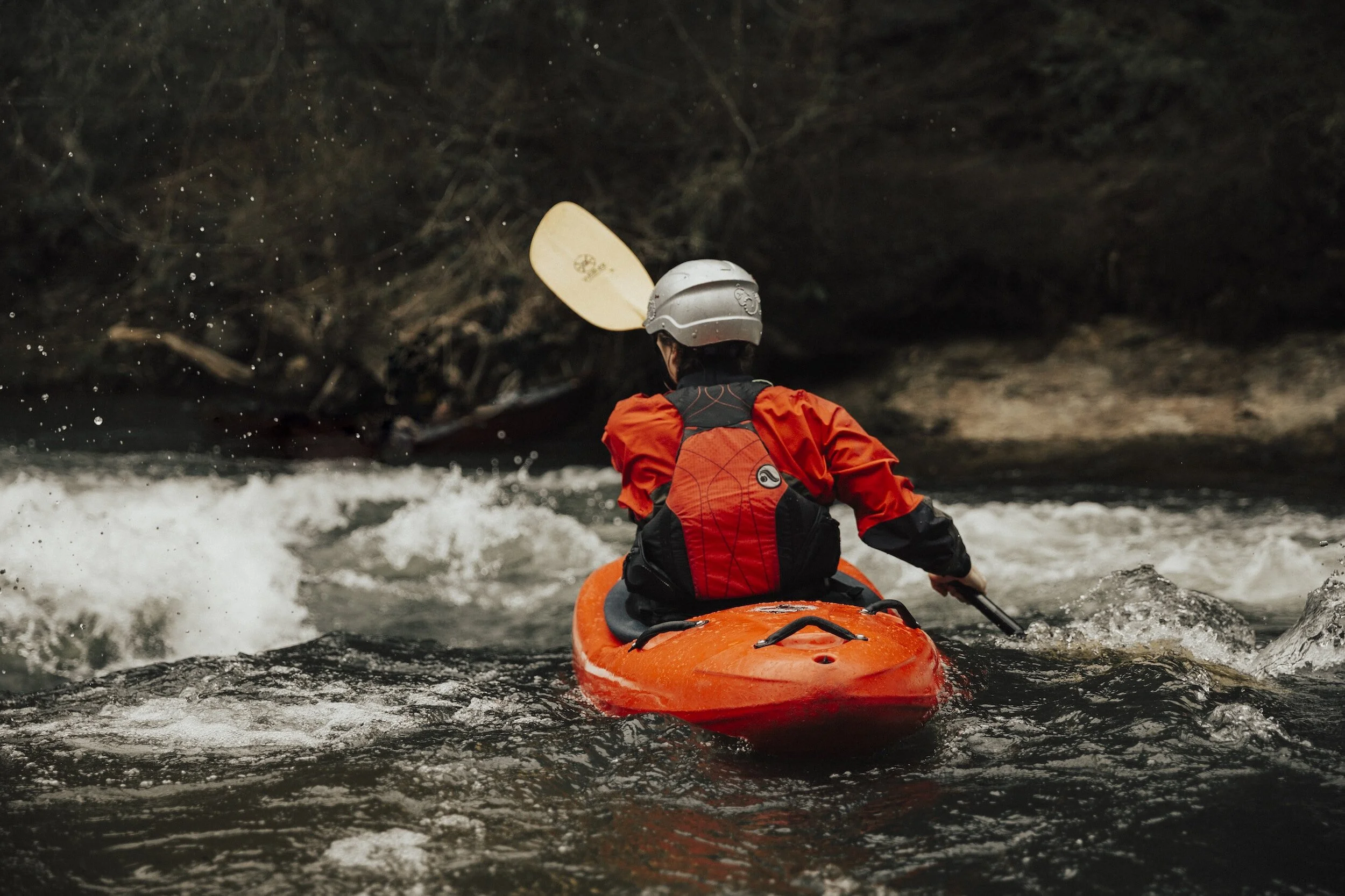
While horseback riding and hiking are the two main outdoor recreations drawn to The Big South Fork National River & Recreation Area, the national park is also recognized as one of the region's best whitewater paddling destinations, with late winter and spring being the primary paddling season on the river. The best whitewater paddling is The Gorge and The Canyon runs, which are located just east of Laurel Fork Rustic Retreat.
River Access Points
Scott County River Runs
For whitewater paddlers in and around Scott County!
Show river runs »
Peters Bridge to Brewster Bridge
The upper-most run takes paddlers along a 6-mile stretch of the Clear Fork River. Put-in is at Peters Bridge on Peters Ford Road and take-out is at Brewster Bridge on S.R. 52 near Historic Rugby. The average drop is 7 and the difficulty is Class I-II. The trip takes about a half day to complete.
Brewster Bridge to Burnt Mill Bridge
The 10.5-mile trip along Clear Fork offers some of the most beautiful scenery on the river. Put-in is at Brewster Bridge on S.R. 52 and take-out is at Burnt Mill Bridge on Honey Creek Road near Robbins. The average drop is 12 and the difficulty is Class II-III. The rapid of note is Decapitation Rock, where the stream goes beneath an undercut rock.
Burnt Mill Bridge to Leatherwood Ford
This is the stretch of water that gives the Big South Fork its fame among paddlers. Put-in is at Burnt Mill Bridge on S.R. 52 near Robbins and take-out is at Leatherwood Ford on S.R. 297 near Oneida. The distance is 11 miles, the average drop is 20 and the difficulty is Class III-IV. Sometimes referred to as the "Canyon Run," this stretch of river begins on Clear Fork and continues after the confluence with New River onto the Big South Fork, through the deepest part of the Big South Fork gorge. Some paddlers choose to shorten the run by putting in at the confluence off of John Long Road near Oneida, which requires a hike into the gorge from a trailhead. The run includes the "Big 3" rapids of The Ell, Double Drop and Washing Machine, a series of Class IV rapids just downstream from the confluence.
White Oak to Burnt Mill
An 11-mile trip down South White Oak Creek to Clear Fork, with roughly half the trip occurring on the smaller creek and the second half on the river. Put-in is at White Oak Bridge on S.R. 52 near Historic Rugby and take-out is at Burnt Mill Bridge on Honey Creek Road near Robbins. The average drop is 13 and the difficulty is Class II. There are no major rapids but plenty of scenic beauty.
New River to Leatherwood
This 15.5-mile trip is similar to the Burnt Mill to Leatherwood run, beginning on New River and continuing on the Big South Fork past the confluence. Put-in is at New River Bridge on U.S. Hwy. 27 in Helenwood. Takeout is at Leatherwood Ford on S.R. 297 near Oneida. The average drop is 14 and the difficulty is Class I-IV. New River is a gentle stream for most of the stretch, beginning to roughen shortly before the confluence. After the confluence, the rapids pick up considerably in intensity, including the "Big 3" of The Ell, Double Drop, and Washing Machine. The trip requires a day of serious paddling to complete. For overnight trips, a nice camping spot is available at the confluence before the trickiest part of the journey begins.
Zenith to Leatherwood
This 8.5-mile trip includes no serious rapids but plenty of scenic beauty along North White Oak Creek and continuing on the Big South Fork of the Cumberland River. White Oak Creek empties into the South Fork just south of the O&W Bridge, where the river calms considerably after emerging from "The Canyon." Put-in is at the old Zenith Mine off Mt. Helen Road in Fentress County. Take-out is at Leatherwood Ford on S.R. 297 near Oneida. The average drop is 22 and the difficulty is Class II.
Leatherwood Ford to Station Camp
This 8-mile stretch is mostly calm water suitable for beginners. However, Angel Falls is located along the route and should be portaged at any level. The rapid is not marked. Put-in is at Leatherwood Ford on S.R. 297 near Oneida and take-out is at Station Camp on Station Camp Road near Oneida. The average drop is 5 and the difficulty is Class I-II (except Angel Falls, which is Class IV). Some paddlers choose to float on to Blue Heron for a multi-day trip.
Station Camp to Blue Heron
A 19-mile run of mostly calm waters except for Devil’s Jump, which should be portaged at any water level. The rapid is not marked. The run typically takes two days to complete. Plenty of suitable camping locations can be found on either side of the river (a Backcountry Camping Permit is required; the cost is $5 and the permit is available from the Bandy Creek Visitors Center and several area merchants). Put-in is at Station Camp on Station Camp Road near Oneida and take-out is at the historic Blue Heron mining community near Stearns, Ky. The average drop is 5 and the difficulty is Class I-II.
Provided by DiscoverScott.com
Experience Paddling at Big South Fork


Birdwatching is easier than you think — especially at Big South Fork!